/ AsG/August 02, 2022 Guangzhou -- The 24th China Highway Informatization Conference was held in Changsha International Convention and Exhibition Center from July 27 to 28. With the theme of "Digitalization, networking and intelligence", the conference invited leading experts in the industry to jointly explore the innovative development of highway information planning, design, construction, management and service as well as the application and development of the new generation of information technology in the highway. More than ten thousand insiders attended the conference and visited.
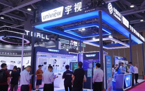
Xiamen Satellite Positioning is invited to participate in the exhibition and present the intelligent products, solutions and practical achievements of Xiamen satellite positioning in the field of smart highway to the guests.In the S319 booth of E3 Pavilion, Xiamen satellite positioning, led by the development of highway digitization, displayed the integration and innovation results of cutting-edge technologies such as Beidou, Internet of Things, cloud computing, big data, artificial intelligence and various scenes of smart highway. Pooling wisdom to help the high-quality development of the industry.
In recent years, Xiamen Satellite positioning has continued to layout the field of intelligent highway, and a number of projects have been implemented. It has created a three-dimensional intelligent highway overall solution with "construction, management, maintenance and transportation" as the core, covering the core business of road network monitoring, project management, command and dispatch, road maintenance, information release and so on. In Xinjiang Wujiaqu, Zhejiang Jinhua, Sichuan Xuanhan has landed smart road products.
On-site direct attack on core products, a number of smart transportation products highlight application revealed
Combined with a series of products and solutions for the current demand of smart transportation, Xiamen satellite positioning has comprehensively presented a series of scenario-based solutions for smart transportation. Including TOCC, highway network operation monitoring and early warning system, Four good rural road management platform, traffic integrated administrative law enforcement information system, highway project management system, etc., received the attention of the participants.
< b> 1. Transportation Integrated Operation Coordination and Emergency Command Center (TOCC)In the TOCC display area, Xiamen satellite positioning through Demo, around 3 support platforms, 6 application fields, N business application system, namely "3+6+N" architecture, to demonstrate the whole system. It also focuses on providing comprehensive support and services for urban transport management departments in data aggregation and sharing, situation awareness analysis, dynamic monitoring and early warning, data decision support, emergency command and dispatch, public information services and other aspects. At present, our TOCC products have been applied in many places such as Xiamen in Fujian, Wuhan in Hubei, Tongling in Anhui, Yingkou in Liaoning, etc., which has attracted wide attention from guests at the exhibition.
2. Highway network Operation monitoring and early warning system
In the exhibition area of highway network operation monitoring and early warning system, Xiamen Satellite Positioning shared the thinking and harvest of intelligent road network construction with industry peers and customers, and demonstrated the whole process of emergency disposal command according to the emergency plan and process of highway emergency treatment.
The system can realize the monitoring and early warning of the traffic flow, congestion degree, section interruption, node blocking degree, facility health condition and meteorological environment of the highway, national and provincial trunk roads and traffic transfer stations. By aggregating the relevant data of the road network and analyzing the construction situation of the road network, the maintenance investment situation of the traffic post infrastructure, the maintenance inspection situation and the blocking event, the traffic management department can assist to provide the attitude assessment of the road network operation situation.
3, Sihao rural road management platform
In the display area, Xiamen satellite positioning takes the management of Sihao rural road in Xuanhan County as an example to demonstrate how to integrate roads at all levels on the basis of "one map", establish one gear for one road, one policy for one road, and form a hierarchical road length system management system. Through the implementation of comprehensive real-time dynamic supervision such as construction projects, maintenance management, road administration inspection, operation management and emergency treatment, the platform achieves real-time leave marks and closed-loop management, providing timely and accurate decision support data for traffic management departments.
< b> Four, traffic integrated administrative law enforcement information systemIn the display area, Xiamen satellite positioning shows how the system is combined with the on-board cloud head, law enforcement terminals and other equipment to build a comprehensive administrative law enforcement system integrating the front-end traffic integrated law enforcement system and background support system. To achieve "full space coverage, full work coverage, full task coverage, full responsibility coverage".
Five, highway engineering project management system
As the first product in the exhibition, Xiamen satellite positioning first through the video to show the highway engineering project management system in the whole life cycle of infrastructure construction plays a role; Subsequently, Demo was used to conduct detailed demonstration of modules in the system such as monthly maintenance workload, highway technical status assessment, monthly maintenance data statistics, maintenance project budget and expenditure, etc., which attracted the attention of professional audience on site.
Booth services intended to win the new and old customers site praise
Xiamen satellite positioning adhere to the "do well do new", not only carefully planned to display fine products, but also actively explore a new model of on-site interaction, and strive to create a new experience of immersive exhibition.
Our company exhibited many wonderful interactive products. Interactive Demo brought the practical application of smart highway and smart transportation products to the scene, attracting guests to stop extensively; Through exclusive interactive games and customized enterprises around, let more visitors to Xiamen satellite positioning; Carefully prepared chrysanthemum tea and fat sea, let every visitor feel the consistent warmth of satellite positioning service, won the new and old customers praise.
Since 2016, our company has been helping the development of smart transportation in Macao Special Administrative Region, providing high-quality smart taxi products and services for Macao. On the day of the launch, the company's customers came from thousands of miles away from Macao under the scorching sun to visit our booth, and took photos with Guo Yanfeng, general manager of South China Region of the company, to discuss the future business development of both sides.
< /p>< /p> With the continued empowerment of new technologies, more roads will be endowed with intelligent "brains". In the future, Xiamen Satellite Positioning will continue to increase investment in the field of intelligent transportation, closely cooperate with the upstream and downstream partners of the industrial chain, seize the development opportunities, and provide innovative solutions for the digital transformation of smart highway with the advantage of better understanding of customers and careful service.