On Oct 28, the 10th China Surveying, Mapping and Geographic Information Technology Equipment Exhibition was held in Zhengzhou, Henan province. Hebei Whole Road Technology with the industry's high precision map data products and its independent research and development of data acquisition equipment, dressed in this exhibition.
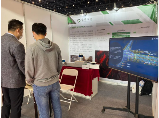
Photo: The whole Road technology at the 10th China Surveying, Mapping and Geographic Information Technology Equipment Exhibition
Hebei Whole Road Technology focuses on technological innovation in the field of autonomous driving map and mapping. It has developed high-precision acquisition solutions, highly automated spatial map data processing platform and customized service system, which can realize efficient mass production of high-precision map for trunk roads and support map solutions for scenario-based unmanned driving applications.
At present, the Whole Way Technology has established a complete technical system through independent collection and production and multi-source updating, including autonomous collection system, full-time collection monitoring and fusion system, self-developed binocular stereo vision recognition system, automatic mapping and manual operation platform, fully equipped with the ability to mass-produce high-precision map of trunk roads. Meanwhile, based on AI technologies such as computer vision, laser point cloud and deep learning, we have developed a highly automated and mass-produced spatial graph data processing platform with independent intellectual property rights. Combined with the application of edge computing, it provides a high-precision positioning solution for assisted driving and scenario-based unmanned driving, and groundbreaking realizes quasi-real-time data iteration and service distribution.
With the increasing requirements for equipment stability, reliability and accuracy in surveying and mapping acquisition operations, higher goals are also proposed for the diversification of mission equipment and the advancement of surveying and mapping technology. In this year's China Surveying, Mapping and Geographic Information Technology Equipment Exhibition, the Whole Way Technology not only showed its data innovation solutions, but also brought its self-developed acquisition equipment and solutions that can adapt to different operation scenarios and needs.
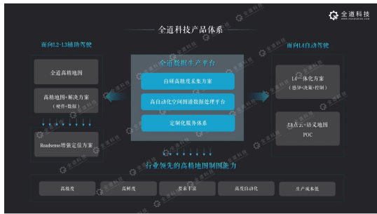
Figure: Whole technology product system and technical capability
According to the requirement of L2-L3 scene mapping, the binocular vision acquisition structure and binocular vision scheme are developed by All Way Technology. It adopts the mapping integrated navigation and post-solution scheme, which can guarantee the map accuracy. At the same time, the high stability structure and the camera or GNSS microsecond joint calibration jointly ensure the relative accuracy of the map. On this basis, the deep learning technology can be applied to realize automatic identification of core elements, which will significantly reduce labor costs.
For the L4-L5 scene, the vision and LiDAR fusion scheme is also equipped by the Whole Way Technology. Through the joint calibration of self-developed camera, LiDAR and IMU multi-sensor, the scheme uses IMU and SLAM technology to realize point cloud map construction, which can support the production of various scenic spots such as highways, urban roads, underground parking lots, and also supports the collection of self-mining equipment and customer automatic driving equipment. It has the advantages of high fusion accuracy, full scene mapping and high flexibility of collection scheme. At the same time, semantic map can be produced by visual scheme to realize the high degree of automation of semantic map and point cloud map, which has great advantages in acquisition cost.
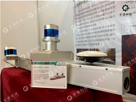
Image: Allway Technology self-developed vision and LiDAR acquisition equipment
In 2020, Hebei Whole Road Technology and China Mobile reached cooperation, relying on its advantages in high-precision map data collection, research and development and technical service innovation, actively expand technological innovation in 5G related fields, and at the same time provide China Mobile with 5G high-precision spatio-temporal information collection services. The results of the cooperation will be used to ensure road safety and control intelligent driving vehicles under the 5G mobile network, providing a guarantee for accelerating the development of 5G intelligent driving. The project was also awarded the WGDC Innovative Application Case of the Year Award.
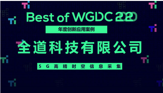
Photo: WGDC Innovative Application Case of the Year Award
Along with the evolution of intelligent driving and the new infrastructure era, relying on its profound accumulation in artificial intelligence, autonomous driving, data acquisition and application and other fields, the whole Way technology will also make outstanding contributions to promote the coordinated development of intelligent transportation. At the same time, we will join hands with more ecological partners to create a new highland for industrial cross-border integration.